Blog

  • 15 Amazing Things to Do in Moab Without Hiking

    15 Amazing Things to Do in Moab Without Hiking

    Moab, Utah is famous for its hiking trails, but you do not need to trek across slickrock to enjoy it. Scenic drives, accessible viewpoints, river adventures, museums and guided tours make the region one of the most rewarding destinations in the American Southwest for travelers who prefer to avoid long hikes.

    This guide covers fifteen things to do in Moab without hiking. Some attractions involve short walks from a parking area, and not every surface is wheelchair accessible. If you have specific mobility needs, confirm accessibility and current conditions with the managing agency or tour operator. The suggested visit times are planning allowances, not live schedules.

    Moab without hiking: quick picks

    • Best national park drive: Arches.
    • Best canyon panorama: Dead Horse Point or Island in the Sky.
    • Best scenic river drive: UT 128.
    • Best indoor activity: Moab Museum or Moab Giants.
    • Best guided experience: calm-water boat tour.

    Table of contents

    1. Drive the Arches National Park scenic road

    Suggested time: 2–4 hours.

    Arches National Park is an excellent starting point for non-hikers. Its paved scenic road passes immense sandstone towers, balanced rocks, fins and distant arches. Stop at established pullouts, enjoy the changing views and turn around whenever your group has had enough. A short visit can concentrate on the main road and Windows area; a longer drive gives you time to explore several viewpoints.

    The National Park Service says that advance timed-entry reservations are not required in 2026, although entry may be temporarily diverted during congestion. Normal entrance fees apply. Check the current rules for your travel year, arrive early if possible and never park outside marked areas. You do not need to attempt a trail to experience the landscape.

    More information: visitor guide.

    2. See Park Avenue and Courthouse Towers
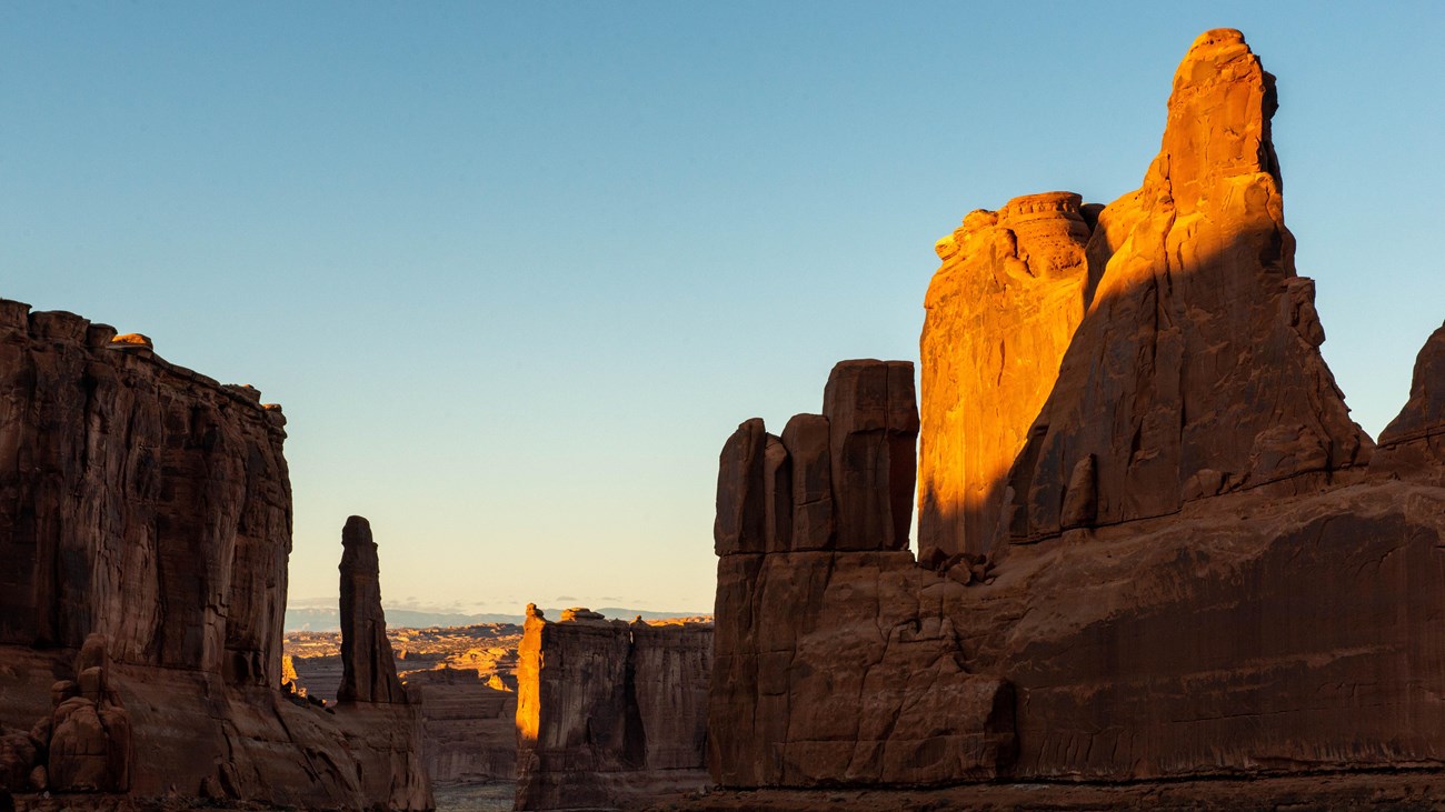
    Sunlit sandstone towers at Park Avenue viewpoint
    Photo: NPS/Veronica Verdin (public domain).

    Suggested time: 20–40 minutes.

    Park Avenue is an impressive corridor of sandstone walls and towers near the beginning of the Arches drive. A paved path leads from the parking area to a viewpoint. You can appreciate the scene without descending the stairs into the canyon or walking the entire trail. The Courthouse Towers area offers other dramatic roadside views as you continue.

    Use the viewpoint rather than following hikers downhill. If traveling with a mobility aid, check the NPS accessibility information for current surface conditions. The morning and afternoon light reveal different textures in the rock, so there is no single required time to visit. Bring water even for a short stop and use the marked viewing areas.

    More information: visitor guide.

    3. Admire Balanced Rock

    Suggested time: 15–30 minutes.

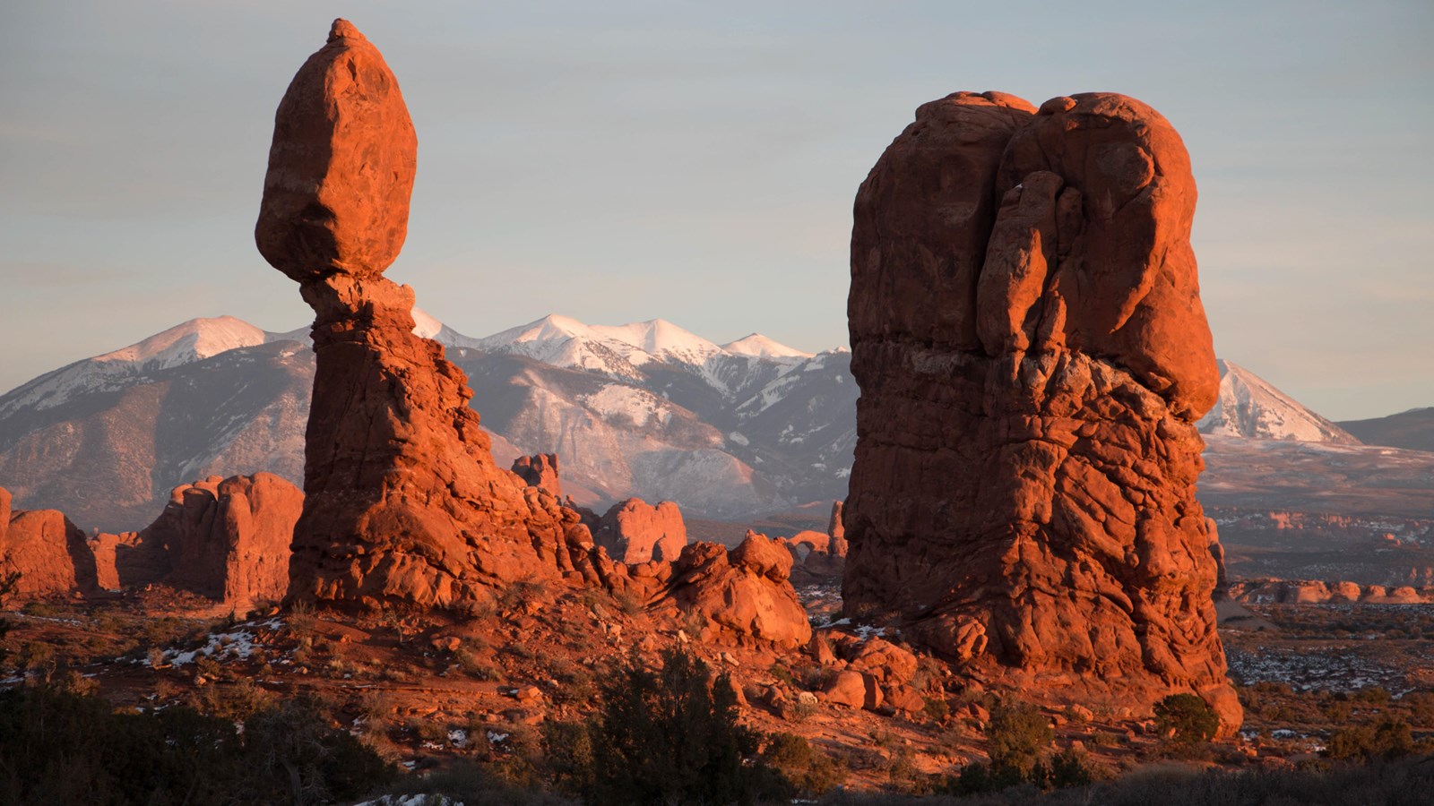
    Balanced Rock is one of the easiest recognizable landmarks to enjoy in Arches. A massive sandstone boulder appears to balance on a slender pedestal, and the formation can be seen from the park road itself. The beginning of its short viewing path is paved and level according to the park, making this a particularly useful stop for travelers who do not want a hike.

    You do not need to circle the rock. Enjoy the main view, look toward the distant mountains and continue when ready. Do not climb the formation or leave established surfaces for a photo. This stop is also a good opportunity to rest and decide whether to continue to the Windows or turn back toward town.

    More information: visitor guide.

    4. View Delicate Arch from a distance

    Suggested time: 20–40 minutes.

    Delicate Arch is the famous symbol of Utah, but the strenuous walk to its base is not the only way to see it. Drive to the designated Delicate Arch Viewpoint parking area and use the lower viewing area. From there, the arch appears small on the distant skyline, so binoculars or a camera with a zoom lens are useful.

    The lower viewpoint involves a short approach on a packed surface; the upper viewpoint and main Delicate Arch trail are more demanding. Do not confuse the viewpoint parking area with the main trailhead at Wolfe Ranch. If mobility is limited, check the park’s current accessibility guidance and be realistic about what the distant view looks like. It is a rewarding stop precisely because you can skip the long hike.

    More information: visitor guide.

    5. Explore Island in the Sky in Canyonlands

    Suggested time: Half a day.

    Canyonlands National Park has several districts, but Island in the Sky is the best fit for a scenic driving day from Moab. Its paved road follows a high mesa with views into immense, branching canyons. Green River Overlook, Buck Canyon Overlook and Grand View Point are especially useful stops because the National Park Service identifies accessible viewing areas at each.

    Allow more time than the map suggests because the views encourage frequent stops. Bring a picnic, water and offline directions. Do not assume that the rugged Needles or Maze districts offer the same convenient experience. The Island in the Sky visitor center is a useful orientation point, and you can enjoy the main landscape without descending into any canyon.

    More information: visitor guide.
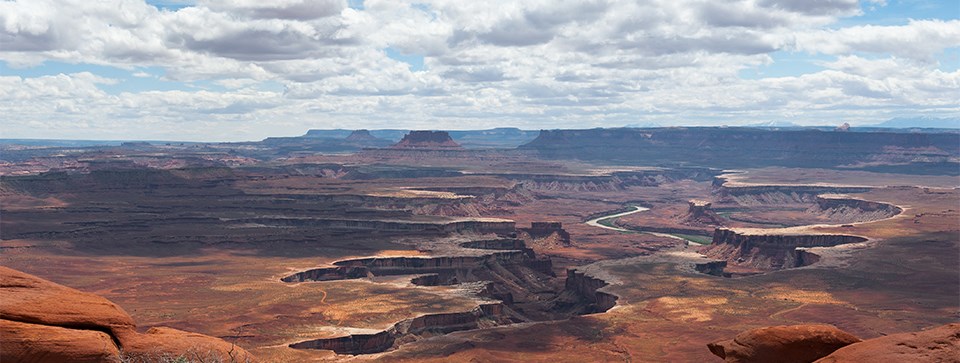
    Green River winding through the canyon below Island in the Sky
    Green River Overlook. NPS/Neal Herbert, public domain.

    6. Visit Dead Horse Point State Park
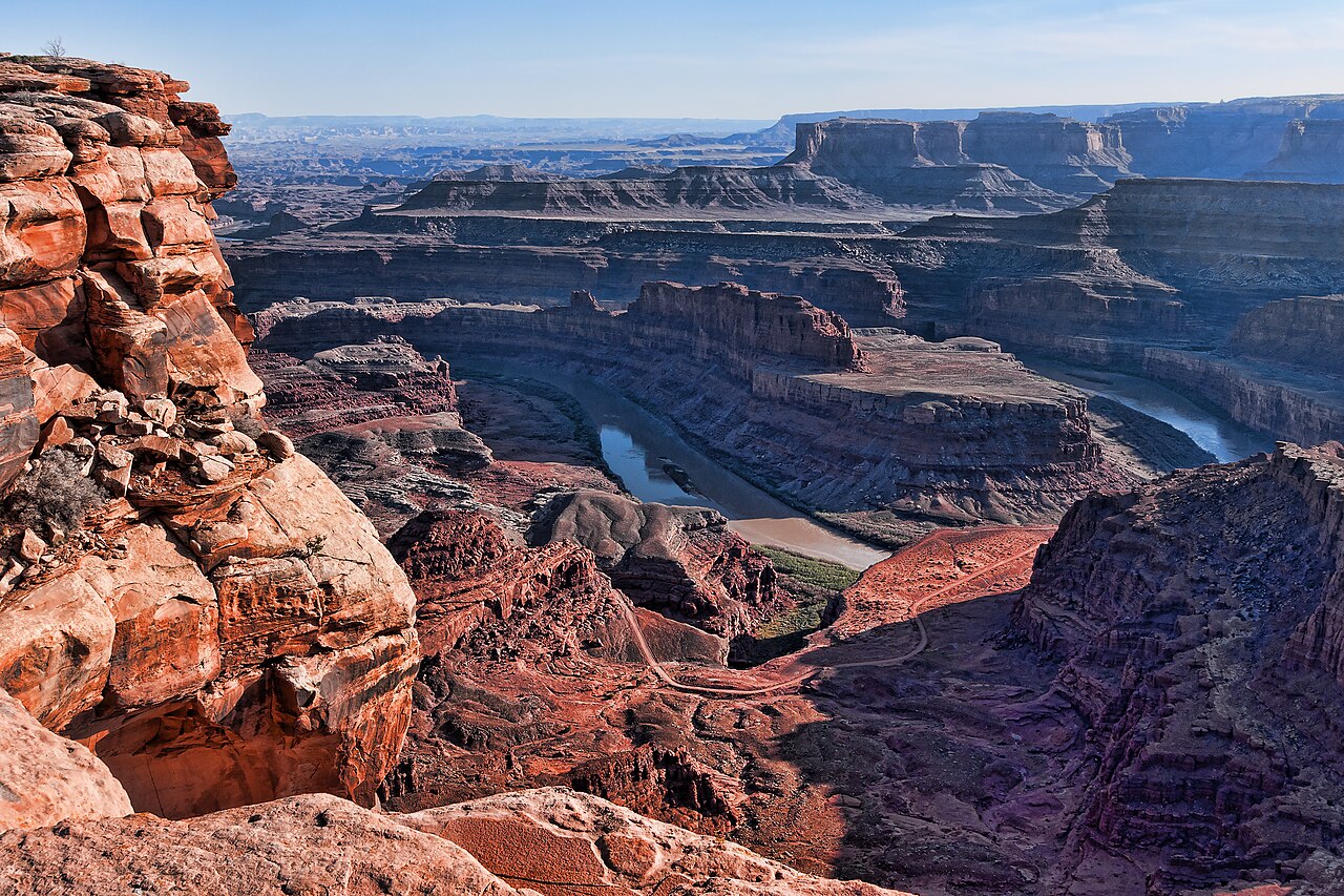
    Colorado River winding through the canyon below Dead Horse Point
    Photo: Jean-Christophe BENOIST / Wikimedia Commons, CC BY 3.0, resized.

    Suggested time: 1–2 hours.

    Dead Horse Point State Park offers a spectacular view of the Colorado River far below a sandstone plateau. Its main overlook is reachable by a short paved path from the parking lot; Utah State Parks identifies that approach as ADA accessible. It is a standout choice for travelers who want a memorable canyon panorama without a long hike.

    The state park charges admission separately from nearby national parks. Combine it with Island in the Sky because both are reached from UT 313, but allow enough time to appreciate each destination. The main overlook path is different from the longer rim trail system, which crosses rougher surfaces. Stay within designated viewing areas and bring layers for wind at the exposed rim.

    More information: visitor guide.

    7. Drive Upper Colorado River Scenic Byway (UT 128)
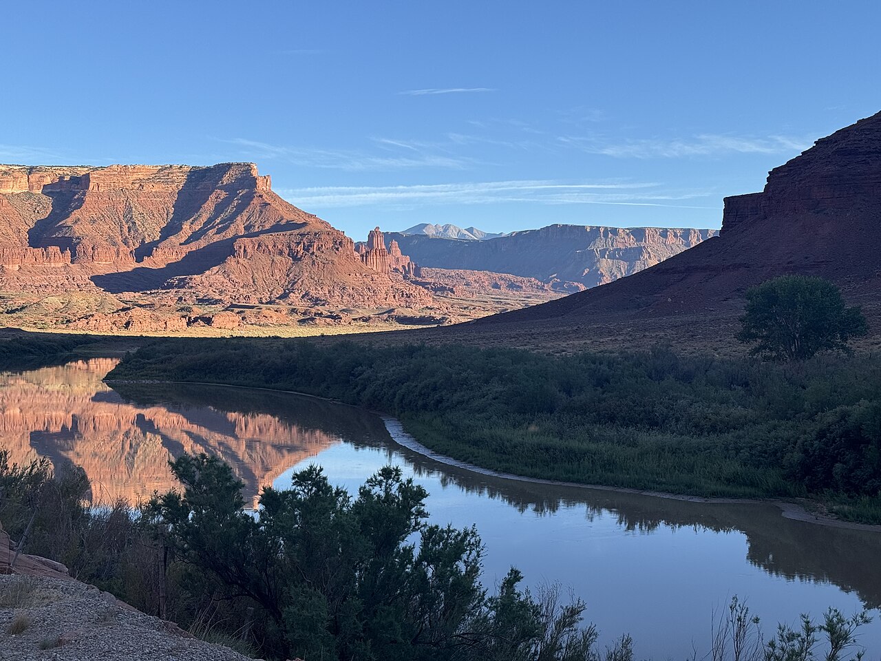
    Colorado River reflecting red cliffs along Utah Route 128
    Photo: Ben1152000 / Wikimedia Commons, CC BY-SA 4.0, resized.

    Suggested time: 2–3 hours.

    UT 128, often called River Road, follows the Colorado River through a dramatic sandstone corridor northeast of Moab. It offers changing views of cliffs, river bends, ranch country and the Castle Valley landscape. You can enjoy much of the scenery from the passenger seat, stopping at legal pullouts for photographs or a quiet picnic.

    There is no need to drive the entire byway if your time is limited. Pick a turnaround point that fits the daylight and your energy. Roads near the river can be affected by weather, and services are limited outside town. Never stop in a travel lane, and respect private property. This drive makes an excellent alternative to a second national park visit.

    More information: visitor guide.

    8. Follow Potash Road (UT 279)

    Suggested time: 1–2 hours.

    Potash Road follows a different stretch of the Colorado River southwest of Moab, beneath tall sandstone cliffs. The paved section offers views of the river, the famous Wall Street climbing area and roadside rock art. It is a compact scenic drive that can be combined with a relaxed afternoon in town.

    Do not continue onto unpaved backcountry roads simply because a navigation app suggests a loop. The route toward Shafer Trail is a very different driving proposition. Use marked pullouts when stopping near rock art, never touch or trace the markings, and remember that some dinosaur track viewpoints require walking on irregular surfaces. If a site cannot be seen safely from your chosen stop, enjoy the roadside scenery instead.

    More information: visitor guide.

    9. Take the Dead Horse Mesa Scenic Byway (UT 313)

    Suggested time: 1–2 hours plus park stops.

    UT 313 is more than a road connecting attractions. As it climbs through canyon country west of Moab, the views shift from low desert to open plateau landscapes. It links the approaches to Dead Horse Point and Canyonlands, making it an efficient route for a day centered on scenic drives.

    Build time into your schedule for the drive itself. Stop only at safe, established places and avoid narrow roadside shoulders. Fuel up in town and check weather before leaving, particularly when winter conditions affect higher elevations. If you have only one day, focus on either the state park or Canyonlands and enjoy this road along the way rather than squeezing in both.

    More information: visitor guide.

    10. Book a calm-water Colorado River boat tour

    Suggested time: Half a day.

    A guided boat excursion offers canyon views from below instead of from the rim. Calm-water jetboat tours are one option for travelers who prefer scenery to whitewater rafting. The river corridor provides a perspective that is hard to replicate from the highway, particularly when cliffs rise above both banks.

    Ask operators about boarding arrangements, seating, shade, minimum age requirements and suitability for your mobility or medical needs. A calm-water tour is not identical to a rafting trip, and no river outing is free of risk. Water levels, weather and seasonal operations affect availability. Follow the guide’s safety instructions and wear required flotation equipment.

    More information: visitor guide.

    11. Join a guided 4×4 sightseeing tour

    Suggested time: Half a day.

    A guided off-road tour can take you into red-rock country without requiring long walks. Local operators offer different styles of trips, from scenic routes to more technical experiences. Choose a gentle sightseeing itinerary if the goal is photography and comfort rather than a thrilling ride over steep obstacles.

    Discuss your needs with the operator before booking. Some tours involve rough rides, high steps, exposed terrain or getting in and out of a vehicle several times. They may not suit everyone with back or neck problems, pregnancy or limited mobility. Never assume a rental SUV is authorized or equipped for a technical trail. Choose an experienced operator and confirm the route, permits and cancellation conditions.

    More information: visitor guide.

    12. Visit Moab Giants Dinosaur Museum and Park

    Suggested time: 2–3 hours.

    Moab Giants is a family-friendly way to explore the region’s prehistoric history. The attraction near US 191 and UT 313 includes indoor dinosaur exhibits and an outdoor route with life-sized models. If your group wants to avoid longer walks, focus on indoor attractions or ask staff which outdoor sections are appropriate.

    The attraction has a separate ticket and opening hours that vary seasonally. Its November 2026 schedule differs from its October schedule, so check the current visitor page before driving there. Ask about accessibility and sensory considerations for immersive attractions. It pairs well with a morning visit to Dead Horse Point or Canyonlands, provided your group has the energy for both.

    More information: visitor guide.

    13. Discover local history at Moab Museum

    Suggested time: 45–90 minutes.

    A museum visit gives your trip a deeper connection to the communities behind the scenery. Moab Museum in downtown Moab explores regional history, Indigenous histories and the people who shaped the area. It is a welcome change of pace on a hot afternoon or a day when wind makes outdoor viewpoints less pleasant.

    Check the current exhibition schedule and opening hours directly with the museum. Take time to read the interpretation rather than treating the visit as a quick photo stop. Downtown restaurants and shops make it easy to combine this activity with a meal, and you can return to your accommodation without another long drive.

    More information: visitor guide.

    14. Explore downtown Moab at your own pace

    Suggested time: 1–2 hours.

    Moab’s downtown offers an easygoing alternative to outdoor recreation. Browse local shops, enjoy a meal, look for locally made artwork and plan the next day’s outing. A relaxed morning in town can be particularly welcome after two days of driving and early starts. You do not have to schedule a tour every day to experience the destination.

    Choose a convenient parking spot and explore only as much as your group wants. Check individual business hours, which may vary with the season. If walking is difficult, plan a few specific stops rather than a long stroll. This is also a good time to restock water, snacks and supplies before visiting the parks again.

    More information: visitor guide.

    15. Enjoy sunset and stargazing from an established viewpoint

    Suggested time: 30–90 minutes.

    Moab’s open desert skies are an attraction in themselves. A sunset at an established viewpoint can reveal changing colors across the sandstone, while clear nights may offer excellent stargazing. You can enjoy either activity without a hiking itinerary. Choose a legally accessible location with safe parking and a clear view.

    Inspect the location in daylight, stay well back from cliff edges and bring warm clothing and a flashlight. Check cloud cover, moon phase and any after-dark access restrictions. Do not walk into unknown canyon terrain at night. A paved viewpoint such as Panorama Point in Arches may suit some visitors; check park conditions and access first.

    More information: visitor guide.

    Two days in Moab without long hikes

    Day one: Visit Arches early, stopping at Park Avenue, Balanced Rock and the Delicate Arch viewpoint. Return to Moab for lunch, then explore downtown or visit the museum. If you have enough daylight, enjoy a short drive along UT 128. Keep the evening flexible.

    Day two: Follow UT 313 to Island in the Sky and Dead Horse Point. Choose a few accessible overlooks and allow time for a picnic. If you prefer a guided experience, replace one park with a river tour. With a third day, add Moab Giants or Potash Road.

    Practical planning tips

    Spring and fall generally offer more comfortable temperatures, but weather can change quickly. Summer heat makes even a short walk demanding, while winter snow and ice can affect scenic roads. Carry extra water, dress in layers and download offline maps. Check separate entrance fees for each national and state park, and remember that a federal pass does not cover all attractions.

    If you need step-free access, check the official park accessibility pages and ask tour operators about boarding. A short trail is not necessarily accessible. Avoid off-road shortcuts, stay on marked paths and protect fragile biological soil crust and rock art.

    Planning a wider Southwest trip? Read our Page, Arizona guide and Las Vegas to Zion road trip guide.

    Frequently asked questions

    Is Moab worth visiting without hiking? Yes. Its scenic roads, canyon overlooks, museums and guided river trips offer a wide variety of experiences.

    Can you see Arches from your car? Many formations are visible along the paved scenic road. Some arches are best viewed from short designated paths.

    Which Canyonlands district is easiest for non-hikers? Island in the Sky, with its paved scenic road and several accessible overlooks.

    Do I need timed entry for Arches in 2026? No advance timed-entry reservation is required in 2026, according to the NPS. Check current rules for later years and possible congestion restrictions.

    How many days should I spend in Moab? Two or three days allow a comfortable mix of scenic drives, overlooks and town activities.

    Final thoughts

    Moab rewards travelers who slow down. Choose a few scenic drives, stop at viewpoints that match your abilities and leave room for rest. You can come away with an unforgettable experience of Utah’s red-rock country without completing a single long hike.

    Sources and photo credits

    Research reviewed November 18, 2026. This is a researched guide, not a claim of firsthand travel.
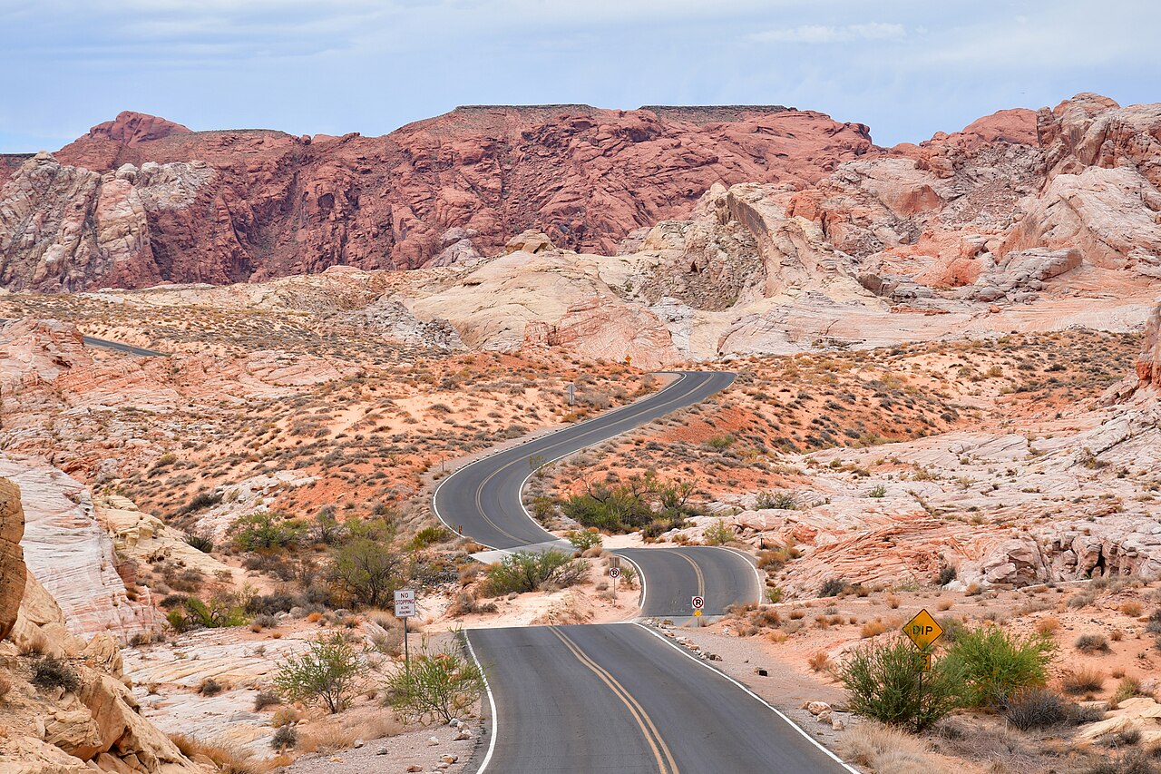
  • 12 Best Stops Between Las Vegas and Zion National Park

    12 Best Stops Between Las Vegas and Zion National Park

    The drive from Las Vegas to Zion National Park is an adventure in its own right. You can leave behind the Nevada desert city, explore red sandstone, travel through an impressive river gorge and arrive among the towering cliffs of southern Utah. The direct drive is manageable in a day, but the best route depends on whether you want a quick transfer or a full scenic road trip.

    This guide covers twelve worthwhile stops, arranged broadly from southwest to northeast. Several are optional detours, not attractions directly beside the interstate. The time allowances below are for sightseeing, not real-time driving estimates. Check current road conditions, opening schedules and park rules before your trip.

    Route at a glance

    • Direct route: I-15 north, then UT 9 east to Springdale.
    • Distance: roughly 160–170 miles, depending on your starting point.
    • Allow approximately 2.5–3 hours for nonstop driving, plus traffic and breaks.
    • Utah is one hour ahead of Las Vegas.
    • Best major detour: Valley of Fire, when open. Best meal break: St. George.

    Table of contents

    1. Lake Mead National Recreation Area

    Redstone Picnic Area shelters beside red sandstone cliffs
    Photo: NPS/A. Cattoir (public domain).

    Suggested stop: 1–2 hours, plus extra driving.

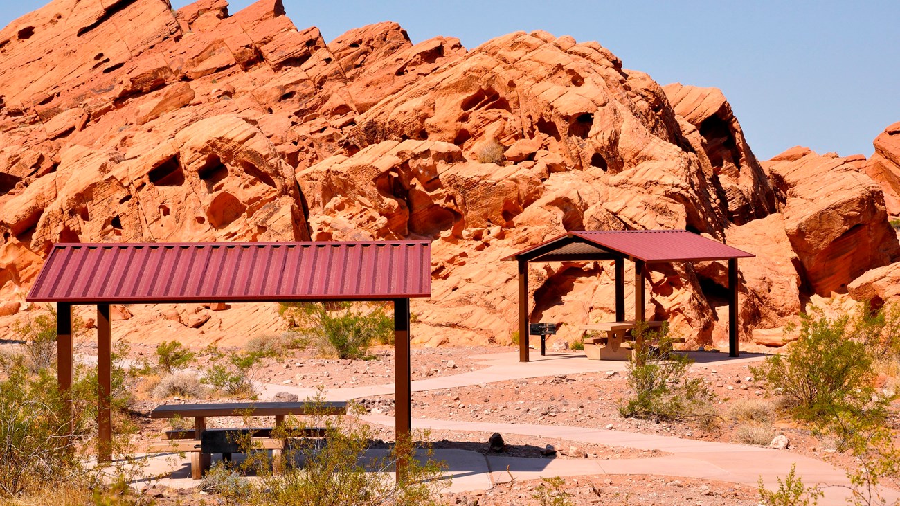
    Northshore Road offers a scenic alternative to the interstate, with desert mountains, distant reservoir views and colorful sandstone. Redstone Picnic Area is a particularly convenient place to see the geology without a demanding walk. The picnic area has restrooms and picnic tables, but no drinking water. Bring everything you need for a comfortable stop, especially in warm weather.

    This is an optional detour rather than part of the direct route to Zion. It works especially well if you plan to approach Valley of Fire from the east. Check current road access, recreation-area admission and fuel availability. Do not assume every road connects to a public beach or marina. Allow extra time for slower roads and photo opportunities; if your Zion arrival time is fixed, skip this detour and drive directly toward Mesquite.

    Plan your visit: official visitor information.

    2. Valley of Fire State Park

    Suggested stop: 2–4 hours.

    Valley of Fire is the most dramatic scenic detour on this drive. Bright red Aztec sandstone formations contrast with pale desert slopes and blue skies. Explore the paved roads and designated viewpoints, and consider Elephant Rock, Atlatl Rock or the visitor center when access and conditions permit. The rock art viewing area at Atlatl Rock involves stairs, so check the route before attempting it.

    Important 2026 update: Nevada State Parks announced a Monday–Thursday closure of the west entrance beginning August 3, with access via the east entrance on those days. Construction is expected through the end of 2026. The whole park is scheduled to close December 1–14, 2026. Several exposed trails also close during summer heat. Verify the latest notices before departing, and do not attempt closed trails or enter during the maintenance closure. This park deserves its own time rather than being treated as a quick roadside photo stop.

    Plan your visit: official visitor information.

    3. Lost City Museum, Overton

    Suggested stop: 45–75 minutes.

    The Lost City Museum provides historical context for the desert landscapes you have just seen. Its exhibits interpret archaeological discoveries and the lives of Indigenous communities in the Moapa Valley. A museum visit is a useful indoor alternative to an exposed walk when the weather is too hot. It can also be a valuable educational stop for children who have been looking at rocks and canyons all morning.

    Check admission, opening days and holiday hours before making the detour. Give yourself enough time to read the exhibits rather than rushing through them. Treat cultural material with respect, never remove artifacts from public lands, and follow any museum photography rules. From Overton, return toward I-15 on NV 169. If you have already spent much of the morning at Valley of Fire, this is the place to decide whether you still have enough time for another stop.

    Plan your visit: official visitor information.

    4. Mesquite, Nevada

    Suggested stop: 20–60 minutes.

    Mesquite is the practical stop before the interstate enters northwestern Arizona. Fuel up, refill your drinking water, eat lunch or stretch your legs at a designated public park. It is an especially useful place to reset your schedule if the morning’s sightseeing took longer than expected. Not every worthwhile road trip stop has to involve a major attraction.

    If you have extra time, check whether the Virgin Valley Heritage Museum is open. Otherwise, a simple meal and restroom break can make the next stretch more comfortable. Check the remaining daylight, temperature and road alerts before leaving. If you have an afternoon reservation in Zion, Mesquite is a sensible place to abandon additional detours rather than rushing the rest of the journey.

    Plan your visit: official visitor information.

    5. Virgin River Gorge

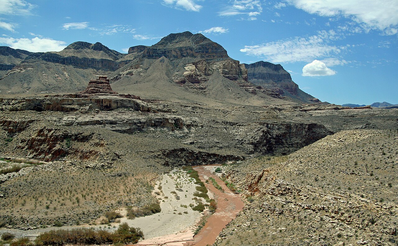
    Layered cliffs and the Virgin River Gorge in Arizona
    Photo: FF23-fr / Wikimedia Commons, CC BY-SA 3.0, resized.

    Suggested stop: Enjoy while driving.

    I-15 briefly crosses Arizona between Nevada and Utah, winding through steep canyon walls in the Virgin River Gorge. This stretch is one of the most memorable parts of the direct route because the scenery comes to you: there is no need to plan a hike or separate attraction. Passengers can enjoy the scale of the rock formations while the driver concentrates on curves and traffic.

    Do not stop on highway shoulders to photograph the gorge. Use only legal designated stopping areas and never distract the driver. Road construction, incidents and weather can cause delays, so check Arizona 511 before entering. If you need a restroom, fuel or a picnic break, use Mesquite or St. George instead of assuming services are available inside the gorge. In winter, pay attention to road notices even if Las Vegas itself is warm.

    Plan your visit: official visitor information.

    6. Historic downtown St. George

    Suggested stop: 45–90 minutes.

    St. George is the first major Utah city along this route and makes a convenient lunch or overnight stop. Its historic downtown has public spaces, local shops and streets suitable for a relaxed break from the car. You can choose a café, stroll around a square or visit an attraction without making the day feel like a race.

    Families interested in natural history could visit the St. George Dinosaur Discovery Site at Johnson Farm instead. Check its opening schedule and allow enough time for the fossil track exhibits. Remember that Utah is one hour ahead of Nevada, so a lunch that seems early on your Las Vegas clock may already be well into the afternoon locally. If staying overnight, choose accommodation based on your next morning’s plans rather than distance alone.

    Plan your visit: official visitor information.

    7. Pioneer Park and Red Hills Desert Garden

    Suggested stop: 30–90 minutes.

    For a taste of southern Utah red rock without driving out of St. George, head to the Pioneer Park area. The surrounding formations and elevated views make a rewarding change from the highway. Nearby Red Hills Desert Garden offers a different experience, introducing plants suited to the dry climate and giving visitors a chance to explore at a gentler pace.

    Choose routes carefully. Rock surfaces in Pioneer Park can be steep and uneven, and a short distance does not guarantee a suitable route for every visitor. Stay away from cliff edges and avoid scrambling on wet sandstone. If traveling with limited mobility or young children, the garden may be a more manageable choice. Combining this area with downtown lunch is easier than trying to fit in another remote state park.

    Plan your visit: official visitor information.

    8. Snow Canyon State Park

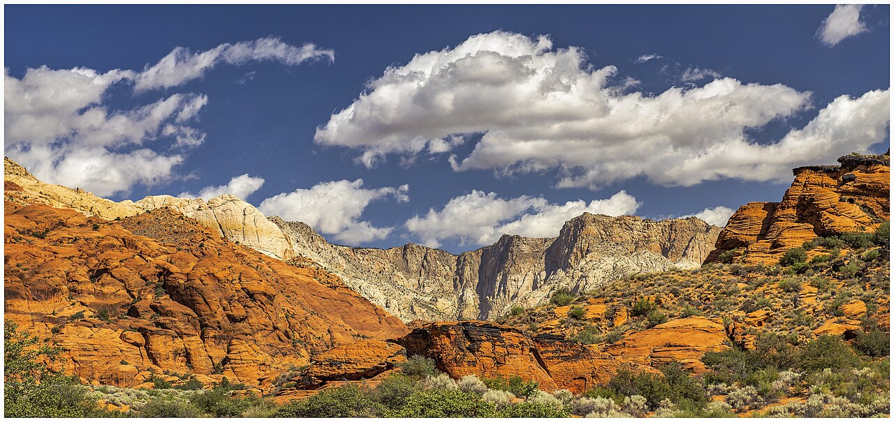
    Red and cream sandstone formations at Snow Canyon State Park
    Photo: Hburkholz / Wikimedia Commons, CC BY-SA 4.0, resized.

    Suggested stop: 2–3 hours.

    Snow Canyon combines warm-colored sandstone, lava rock and sweeping desert views. The contrast between dark volcanic formations and pale or red cliffs makes it a particularly appealing photography destination. Drive the paved park road and choose designated stops that match your group’s energy level. Short walks can add variety, but the scenery alone can justify a visit.

    The park is northwest of St. George, meaning it adds driving as well as sightseeing time. Check current fees, trail notices and access rules through Utah State Parks. Do not try to combine a long Valley of Fire visit with a full Snow Canyon visit on a tight schedule. If you want both parks, stay overnight in St. George and use the following morning for Snow Canyon. Carry water and check summer heat or winter road conditions before visiting.

    Plan your visit: official visitor information.

    9. Quail Creek State Park

    Suggested stop: 30–90 minutes.

    Quail Creek provides a change from dry sandstone landscapes to reservoir scenery. Near the St. George–Hurricane corridor, it is a pleasant choice for a picnic or a short break overlooking the water. The quieter rhythm of a waterfront stop may appeal to families who have already spent several hours in the desert.

    Check the state park’s day-use fees, weather and current access before deciding to visit. Swimming or boating requires appropriate precautions and more time than a simple scenic stop. Wind can make the lake uncomfortable, and busy days can affect parking. Choose this park or Sand Hollow, rather than both, if your goal is reaching Springdale before evening. Bring your own water, and do not rely on every facility being open throughout the year.

    Plan your visit: official visitor information.

    10. Sand Hollow State Park

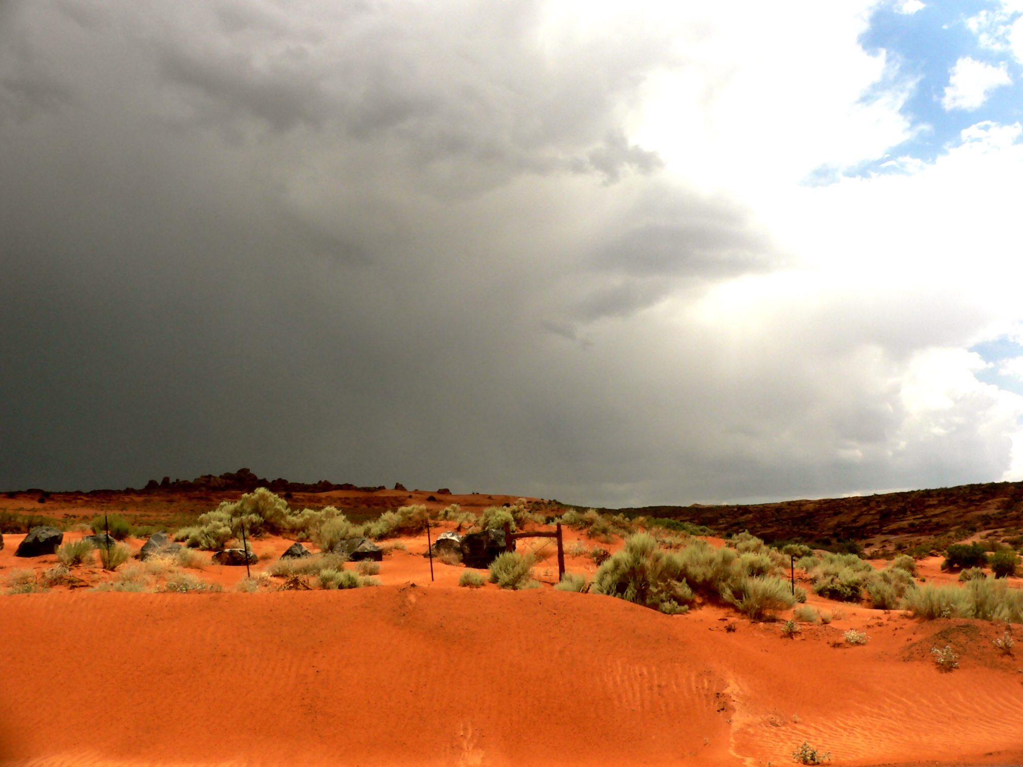
    Red sandstone landscape at Sand Hollow State Park
    Photo: Dylan Duvergé / Wikimedia Commons, CC BY 2.0, resized.

    Suggested stop: 1–2 hours.

    Sand Hollow is known for its red sand and blue reservoir, a striking color combination that feels very different from the steep cliffs in Zion. Day-use areas can provide attractive views without an ambitious outing. It is a good optional detour for photographers or travelers who would rather see a variety of landscapes than visit several similar hiking trails.

    Check current capacity, day-use fees and access restrictions. This is also a destination for off-highway vehicle recreation, but that does not mean a standard rental car is suitable for sand dunes. Stay on appropriate roads, and follow designated recreation-area boundaries. If swimming is permitted and conditions are suitable, supervise children and follow water safety advice. If you have only a few hours before hotel check-in, leave the longer adventures for a dedicated day.

    Plan your visit: official visitor information.

    11. Hurricane and La Verkin

    Suggested stop: 20–60 minutes.

    These gateway communities are the last convenient places to stock up before the drive toward Springdale. Grocery stores and restaurants make them useful for travelers who want breakfast supplies, picnic food or a flexible lodging base. The scenery becomes increasingly dramatic on the final approach toward Zion, and the towns provide a practical pause before that stretch.

    If you plan to stay here, account for the next morning’s drive to the park, parking and any shuttle transfers. Springdale is closer to the pedestrian entrance, while Hurricane and La Verkin may offer other lodging options. Check your own hotel location rather than assuming that all properties labeled Zion are within walking distance of the park. Drive respectfully through residential areas, keep to speed limits and give yourself enough daylight for the final leg.

    Plan your visit: official visitor information.

    12. Springdale, Utah

    Suggested stop: 1–2 hours or overnight.

    Springdale sits beside Zion’s south entrance and is a destination in its own right. The town offers restaurants, lodging and dramatic views of the surrounding cliffs. If you arrive late in the day, a walk around town and an early dinner may be more rewarding than trying to complete a major hike before dark. Staying here can simplify getting to the park the next morning.

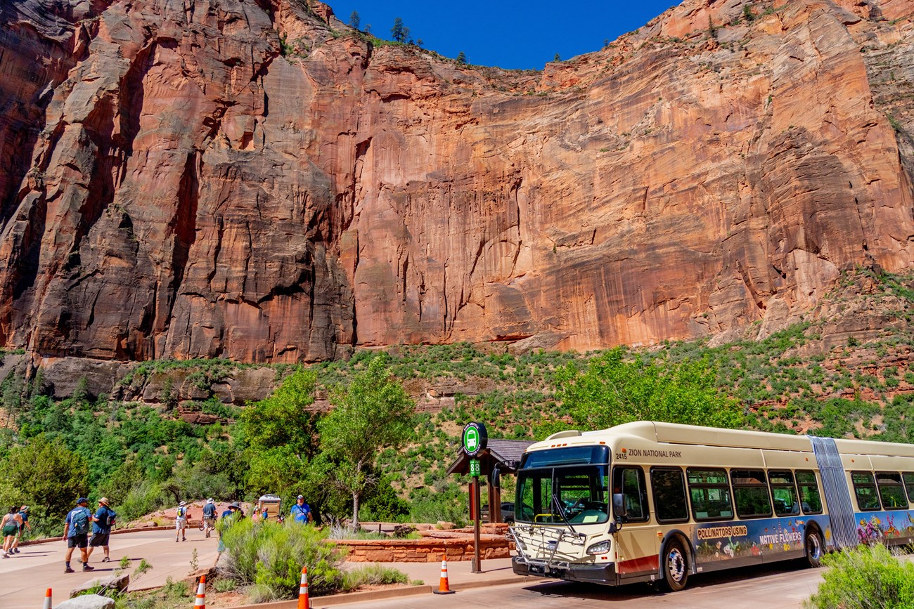
    During Zion Canyon shuttle operations, private vehicles generally cannot drive the main canyon scenic road. The shuttle itself is free, but park admission and some parking are separate. Check the schedule before setting out, especially during the shorter fall and winter service periods. Do not wait for the last shuttle if you can avoid it. If you are driving an oversized vehicle or towing a trailer, consult current restrictions before planning a route through the Zion–Mount Carmel area.

    Plan your visit: official visitor information.

    Zion Canyon shuttle below sandstone cliffs at Big Bend
    Zion Canyon shuttle at Big Bend. National Park Service, public domain.

    Suggested road trip itineraries

    Half-day transfer: Leave Las Vegas, stop for supplies in Mesquite, enjoy the Virgin River Gorge from the car and continue to Springdale. If time permits, take a lunch break in St. George or enjoy the Red Hills Desert Garden. Avoid a major state park detour if you have a fixed appointment in Zion.

    Full scenic day: Leave early for Valley of Fire if open. Visit one or two scenic viewpoints, stop for lunch in Overton or Mesquite, then continue through the gorge and St. George. Choose a short break rather than adding another two-hour park visit. Remember the time difference and entrance construction when estimating arrival.

    Two-day route: Explore Valley of Fire and the Moapa Valley on day one, and stay in St. George. Visit Snow Canyon or one of the reservoir parks on day two before continuing to Springdale. This allows more flexibility for photographs, meals and changing weather. In December, substitute a different stop during Valley of Fire’s maintenance closure.

    Kolob Canyons is another optional excursion north of the main turn toward Springdale. It is a separate district of Zion, with its own scenic drive and seasonal conditions. It is not a shortcut into the main canyon; substitute it for another park rather than adding it to a packed schedule. See the official Kolob Canyons guide.

    Entering Zion: practical planning

    Parking near the visitor center can fill early. Consider paid parking in Springdale and the town shuttle when running. Check the current park shuttle schedule, entrance fees, trail conditions and any applicable permits. A national park pass does not cover Nevada or Utah state park entrance fees. If visiting in November or December, verify the current seasonal service schedule rather than assuming summer hours.

    Bring drinking water, snacks, sun protection, offline maps and a charger. In winter, carry extra layers and check road alerts. Stop only at designated parking areas and avoid rushing the driver. Your best road trip is the one that leaves enough time and energy to enjoy Zion itself.

    Continuing through the Southwest? See our Page, Arizona guide beyond Antelope Canyon and Moab guide for non-hikers.

    Frequently asked questions

    Can I drive from Las Vegas to Zion in one day? Yes, the direct route is manageable as a transfer. Visiting Zion and returning to Las Vegas on the same day leaves limited sightseeing time.

    Is Valley of Fire worth the detour? Yes, when open and conditions are suitable. Allow a few hours for the park plus the additional driving.

    Is Hoover Dam on the route? No. It lies southeast of Las Vegas and requires an additional detour.

    Do I lose an hour going to Zion? Yes. Utah is one hour ahead of Nevada.

    Do I need a shuttle reservation? Zion’s regular canyon shuttle does not require a reservation, but check service dates and park admission requirements.

    Final thoughts

    Choose one major scenic stop, a comfortable meal break and a few optional viewpoints. You do not have to visit all twelve attractions in a single trip. The road to Zion is full of memorable landscapes, and a flexible schedule lets you enjoy them without feeling rushed.

    Sources and photo credits

    Research reviewed November 18, 2026. This is a researched planning guide, not a claim of firsthand travel.
  • 15 Best Things to Do in Page, Arizona Besides Antelope Canyon

    15 Best Things to Do in Page, Arizona Besides Antelope Canyon

    Looking for things to do in Page, Arizona besides Antelope Canyon? You are in the right place. This small northern Arizona city sits close to some of the most dramatic scenery in the American Southwest, from the sweeping Colorado River to the blue waters of Lake Powell. Even if Antelope Canyon tours are sold out, outside your budget or simply not part of your plans, there are more than enough experiences to fill a memorable weekend.

    This research-based guide brings together fifteen ideas, including short walks, scenic drives, water adventures and regional day trips. The time estimates are suggested planning allowances, not live travel times. Some attractions require fees or advance reservations, and desert conditions change quickly.

    Quick trip planning

    • Best first visit: Horseshoe Bend, the dam visitor center and Wahweap.
    • Best water experience: a guided boat or float trip, subject to conditions.
    • Best easy-paced day trip: Navajo Bridge and Lees Ferry.
    • Best remote adventure: White Pocket with an experienced guide.
    • Ideal stay: two or three nights, more if adding distant day trips.

    Table of contents

    1. See Horseshoe Bend

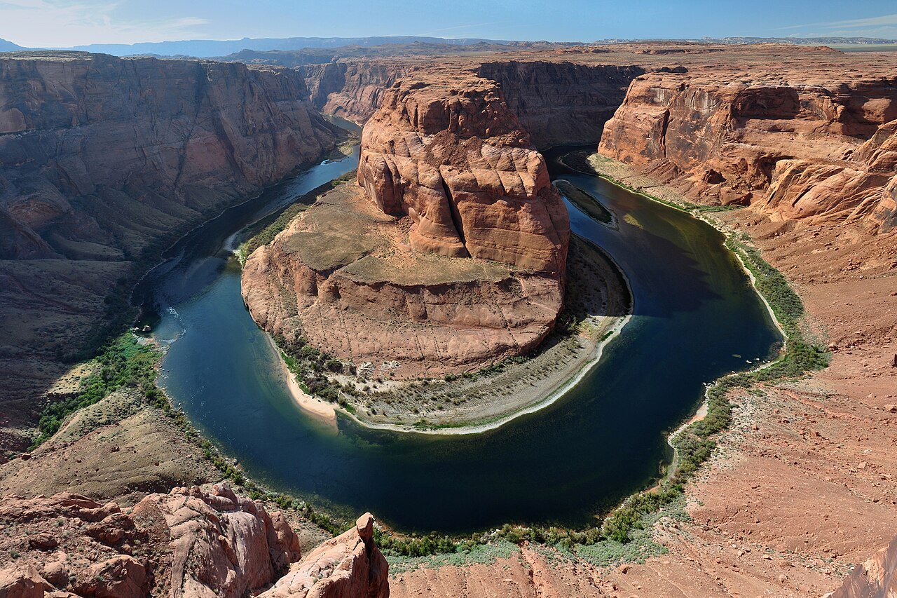
    If you only have time for one stop outside Antelope Canyon, make it Horseshoe Bend. The Colorado River curls around an enormous sandstone promontory, creating the unmistakable U-shaped scene that puts Page on so many Southwest road trip maps. The trail begins at a City of Page parking lot off US 89 and reaches a fenced viewing platform. According to the National Park Service, the walk covers about 1.5 miles round trip on a hardened surface. It is exposed to the sun, and not all canyon edges have barriers.

    Allow an hour to ninety minutes, or longer if you enjoy photography. Early morning is sensible in warm weather, while later light can be beautiful when temperatures are manageable. Bring water, stay behind the railing and supervise children closely. Budget for the separate municipal parking fee; a national park pass does not cover this lot.

    2. Take a scenic boat trip on Lake Powell

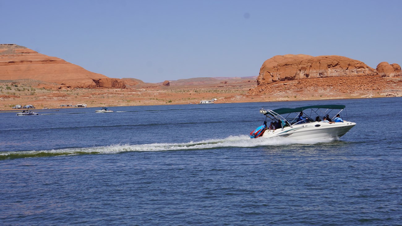
    Lake Powell offers an entirely different perspective on the region. Instead of looking down into a canyon, you travel between sandstone walls and across stretches of blue water. A guided sightseeing cruise is a good choice for travelers who would rather let someone else handle navigation. A rental boat can suit experienced boaters who want flexibility, provided they understand local requirements and conditions.

    Reserve a half day rather than trying to squeeze a lake excursion between two other major attractions. Ask the operator where the trip departs, what it includes, whether there is shade aboard and what happens if conditions change. Lake elevations affect access, and marina facilities are not interchangeable. The NPS boating page and September 2026 lake-access update are useful starting points. Wear a properly fitted life jacket and follow the operator’s safety instructions.

    Boat traveling across Lake Powell with sandstone hills behind it
    Lake Powell boating, National Park Service (public domain).

    3. Explore Wahweap and the Lake Powell overlooks

    Wahweap Overlook shade shelter with panoramic desert views
    Photo: NPS (public domain).

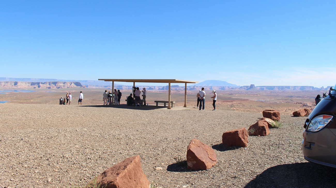
    You do not need to book a boat to enjoy Lake Powell. The Wahweap area north of Page offers wide views of the reservoir, surrounding mesas and desert mountains. Scenic stops are especially useful for families traveling with different energy levels: one person can enjoy the view while another takes photographs, without committing everyone to a long excursion.

    Start with the paved roads and established viewing areas rather than searching for a shoreline shortcut. Plan forty-five minutes to two hours depending on how many stops you make. Bring binoculars, a camera and a snack to enjoy at an appropriate picnic area. Check Glen Canyon directions for the correct entrance, and remember that recreation-area fees may apply. The waterline changes over time, so views and shoreline access may differ from older photographs.

    4. Visit Glen Canyon Dam and Carl Hayden Visitor Center

    Glen Canyon Dam is more than a quick roadside photo opportunity. It explains why Lake Powell exists and provides a starting point for understanding the complicated relationship between water, energy and communities across the American Southwest. The visitor center sits near the dam on US 89 and offers exhibits about the region. It is a particularly useful indoor stop when the afternoon sun is too intense for comfortable hiking.

    Set aside roughly forty-five to sixty minutes, including time for the viewpoints. As of November 2026, the NPS visitor-center information says dam tours are closed, so do not plan around an interior dam tour. Check current hours before leaving. A visit here also pairs naturally with the Hanging Garden Trail or a drive north toward Wahweap. If you have only a few hours in town, combine the center with Horseshoe Bend rather than rushing to distant attractions.

    5. Walk to Glen Canyon Dam Overlook

    Rock steps and trail sign at Glen Canyon Dam Overlook
    Photo: NPS (public domain).

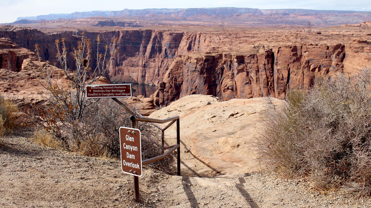
    For a perspective from below the dam’s level, head to the Dam Overlook off Scenic View Road. You can see the concrete structure and the Colorado River cutting through the gorge. The walk is short in distance but includes irregular rock steps and exposed terrain. That distinction matters if you are traveling with someone who struggles with stairs, balance or uneven ground. It is not simply a drive-up accessible viewpoint.

    The NPS day-hikes guide lists the round trip at approximately 940 feet. Allow twenty to forty minutes, depending on your pace and how long you stay. Wear shoes with traction and do not approach the unprotected edges for photographs. This stop works particularly well on the way between your hotel and Horseshoe Bend, or after the Carl Hayden Visitor Center. Skip the descent if the rock is icy or wet.

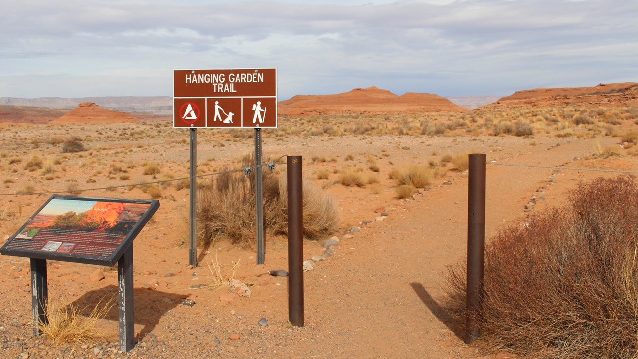
    6. Discover the Hanging Garden Trail

    Hanging Garden Trail sign in the desert
    Photo: NPS (public domain).

    The Hanging Garden Trail reveals a smaller, more delicate side of the desert. A natural seep supports vegetation sheltered by sandstone, creating a striking contrast with the dry landscape nearby. The trailhead is close to Glen Canyon Bridge, so the outing fits easily into a morning of sightseeing around the dam. The NPS trail description gives the round trip as about one mile and rates the route easy to moderate.

    Allow forty-five minutes to an hour, depending on your pace. Carry water even though the trail is short and avoid stepping on vegetation or fragile soil. The garden is a living habitat rather than an attraction to climb into or touch. This is a rewarding choice if you are interested in desert ecology and want something quieter than the major overlooks. Combine it with a longer breakfast in town and a visitor-center stop for an easy half-day plan.

    7. Paddle Lake Powell with a kayak or paddleboard

    A paddle trip brings you close to the texture and colors of the canyon walls. It can be a wonderful way to experience the lake at a slower pace than a motorboat, especially when the water is calm. Beginners should consider a guide or a rental company that provides an appropriate route and safety briefing. Do not assume that an online map or an old trip report reflects current launch conditions.

    Choose a route that fits the group’s swimming ability, paddling experience and stamina. Ask about wind forecasts, boat traffic, water temperature and the distance to the return point. Bring a life jacket, drinking water, sun protection and a waterproof pouch for essentials. If a route involves entering a slot canyon, check land-access rules separately; a water approach does not automatically authorize walking onto tribal land. Strong wind, storms or uncertain access are good reasons to choose a land-based alternative.

    8. Spend time at Lone Rock Beach

    Across the Utah border, Lone Rock Beach offers a close-up view of a large isolated sandstone formation rising near the reservoir. The attraction is the landscape itself: open sky, expansive desert and the possibility of a relaxed lakeside break. It is a pleasant contrast to the more tightly scheduled guided tours around Page. However, access to the beach depends on water levels and the condition of sandy roads.

    The official directions note that much of the access is on sand, with limited hard-surfaced road. A standard rental car should not be taken into deep sand. Park only where appropriate and turn around before the surface becomes unsuitable. If swimming is permitted at your chosen spot, watch for steep underwater drop-offs, boats and changing weather. There is no guarantee of a sandy swimming beach at a particular water level. Bring shade and pack out all litter.

    9. Take a Colorado River float trip

    A guided float below Glen Canyon Dam is a memorable way to appreciate the scale of the canyon without standing at its rim. On suitable trips, the towering walls frame the river, and the landscape changes as the boat follows its bends. This is not the same experience as a whitewater expedition through the Grand Canyon. Look specifically for a calm-water sightseeing trip if your group wants scenery rather than rapids.

    Compare tour descriptions carefully. Ask about the meeting point, total duration including transport, age requirements, boarding arrangements and accessibility. Cold river water and exposure to sun are important considerations even on a gentle trip. Wear the equipment supplied by the operator, and take a spare layer in cooler seasons. It is worth reserving a substantial part of the day for this activity rather than adding an ambitious hike immediately afterward.

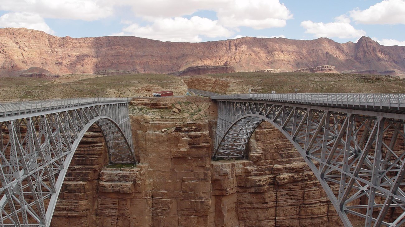
    Historic and modern Navajo Bridge spanning Marble Canyon
    Photo: NPS (public domain).

    Navajo Bridge is a worthwhile excursion southwest of Page along US 89A. The historic pedestrian bridge spans Marble Canyon beside its newer highway counterpart. Looking down to the river gives you a different impression of the Colorado Plateau than Horseshoe Bend: the canyon is narrower, and the bridge provides an unusual perspective on both geology and transportation history. The adjacent interpretive center adds context about the area.

    Bring binoculars if you enjoy wildlife watching; California condors are sometimes seen around the bridge, although sightings are never guaranteed. Allow time to walk across at your own pace and read the information displays. The NPS visitor-center page lists seasonal facilities and hours. Combine this trip with Lees Ferry rather than driving to the same area twice. Stay on designated public paths and do not disturb birds or venture onto closed areas.

    11. Explore Lees Ferry and Lonely Dell Ranch

    Lees Ferry offers something unusual in this region: road access to the Colorado River below the dam. Its history includes ferry crossings, settlement, river travel and early attempts to make a living in an isolated desert setting. Nearby Lonely Dell Ranch preserves parts of that story through historic buildings and an orchard. The landscape feels different from the busy viewpoints near Page, and it deserves enough time to look around thoughtfully.

    From Navajo Bridge, follow the signed Lees Ferry road. The NPS Lees Ferry guide describes a self-guided ranch walk of approximately one mile round trip. River currents are powerful and water is cold, so do not treat the launch ramp as a swimming beach. Stay clear of working boat-launch areas. Bring your own lunch and drinking water; services are limited. A comfortable half day allows both Navajo Bridge and the ranch without needing a strenuous hike.

    12. Hike to the Toadstool Hoodoos

    The Toadstools in southern Utah are a fascinating side trip west of Page. The trail reaches sandstone pillars topped with broad caprocks, giving the formations their mushroom-like appearance. Rather than a narrow slot canyon, this is an open landscape of colorful layers, rock shapes and desert washes. It suits travelers who like geology and photography and want a short excursion outside the main Page attractions.

    The Grand Canyon Trust trail guide estimates a round trip of about 1.6 miles; allow extra time for the drive and photos. Bring water and check the weather, especially during summer thunderstorms. Walk on existing paths and avoid climbing, touching or damaging the fragile columns. Check BLM conditions before exploring farther into the monument. This outing can combine with an overlook on your return to Page.

    13. Book a guided adventure to White Pocket

    White Pocket is a remote area of Vermilion Cliffs National Monument known for sculpted sandstone, intricate textures and unusual white-and-orange patterns. It appeals to travelers who want dramatic rock scenery without making Antelope Canyon the centerpiece of their vacation. The difficulty is getting there, not simply choosing a viewpoint. It is far from regular roadside sightseeing, with deep sand and remote roads.

    The BLM White Pocket guide requires high-clearance four-wheel-drive vehicles for the access roads and warns that inexperienced drivers regularly get stranded. A reputable local guided tour is the sensible choice if you lack the equipment or experience. Treat this as a full-day outing, carry plenty of supplies, and discuss mobility needs with the guide beforehand. Avoid collecting rocks, disturbing formations or leaving marks. If conditions are unsuitable, choose the Toadstools or paved scenic stops instead.

    14. Learn about Page and local Indigenous history

    A visit to Page is more meaningful when you spend some time learning about the people and history of the region. Page developed during construction of Glen Canyon Dam, but the surrounding lands have much older Indigenous histories and remain home to living communities. The city’s visitor information resources, conservancy exhibits and locally owned businesses can help travelers appreciate the place beyond the most photographed locations.

    Set aside a relaxed morning or an afternoon break to explore town, ask about locally led cultural experiences and browse educational exhibits. The official Page visitor website is a useful starting point for current programs. When visiting Navajo Nation land, follow the community’s access rules, use authorized guides when required, and ask permission before photographing people or entering sensitive places. Support local businesses directly rather than treating cultural experiences as a backdrop for photographs.

    15. Enjoy desert sunset and stargazing

    An unhurried sunset is one of the easiest ways to finish a day in Page. Choose a legal, established viewpoint with a safe parking area, and watch how the changing light emphasizes the sandstone layers. On a clear night, the darker areas away from town can also reveal a remarkable sky. You do not need specialized equipment to enjoy it, although binoculars and a tripod can be helpful.

    Choose a location with legal after-dark access and inspect it in daylight. Never walk near a canyon rim in darkness. Take a flashlight, warm clothing, offline directions and a charged phone. Check cloud cover and the moon phase if photography matters to you. A moonlit landscape can be beautiful, while a darker sky is better for seeing faint stars. If your schedule is full, simply make sunset your final stop instead of trying to squeeze in another long drive.

    How to spend two days in Page without Antelope Canyon

    Day one: the essentials. Start early at Horseshoe Bend before the hottest part of the day. Return to town for breakfast, then visit the Carl Hayden Visitor Center. If you are comfortable walking on uneven ground, add the Dam Overlook or Hanging Garden Trail. Save the late afternoon for Wahweap and a relaxed dinner in Page. This itinerary keeps the driving relatively short and leaves room for parking delays.

    Day two: choose water or history. Reserve a morning Lake Powell cruise or a Colorado River float if operators are running and conditions are favorable. Alternatively, drive to Navajo Bridge and Lees Ferry for a scenic, history-focused half-day excursion. In the afternoon, rest, explore town or catch another sunset. Avoid stacking two distant excursions on the same day just to complete a checklist.

    With three days, add the Toadstools or a guided White Pocket trip. If your broader journey includes Utah, read our Las Vegas to Zion road trip guide and Moab guide for non-hikers. They are useful for planning a longer Southwest loop.

    Practical tips before visiting Page

    Spring and fall are often more comfortable for outdoor sightseeing than midsummer. In hot weather, schedule exposed walks early and keep indoor or water-based options flexible. Winter can bring freezing temperatures, snow and shorter daylight hours. Check forecasts and attraction notices just before leaving.

    Book activities separately from lodging, and compare cancellation terms before paying. Arizona and Utah can show different local times depending on the season and whether you are on Navajo Nation land. Confirm the time zone used by every operator, particularly for morning reservations. Download offline maps, fuel up before remote drives and carry more water than you expect to need.

    Fees are not uniform. City parking, federal recreation areas, state parks and tribal attractions have separate rules. A national park pass does not cover everything. Check each attraction’s website instead of relying on a single budget estimate. Choose well-marked paved routes if using a rental vehicle.

    Frequently asked questions

    Is Page worth visiting without Antelope Canyon? Yes. The combination of river overlooks, reservoir scenery, visitor centers and nearby historic sites is enough to justify a two-day stay.

    Can you visit Horseshoe Bend without a tour? Yes, the main overlook is self-guided. You must pay the city’s applicable parking fee and walk the trail.

    What can I do in Page with limited mobility? Consider the visitor center, drive-up lake views and suitable guided boat tours. Check accessibility with providers; even short trails may have slopes or rough surfaces.

    Can I visit Lake Powell in one afternoon? Yes, if you focus on one marina area or an established scenic overlook. Boating deserves more time and advance planning.

    What if I have only one day? Prioritize Horseshoe Bend, Glen Canyon Dam and Wahweap. Choose one optional short walk instead of trying to fit in a remote excursion.

    Final thoughts

    Page is worth exploring at your own pace. Pick the activities that fit your abilities, the weather and your budget rather than following someone else’s checklist. A morning at Horseshoe Bend, an afternoon by Lake Powell and a quiet desert sunset can be a complete adventure in their own right.

    Sources and image credits

    Research checked November 18, 2026. Check official sources for current conditions. This guide is based on research, not a claim of firsthand travel.